B-529
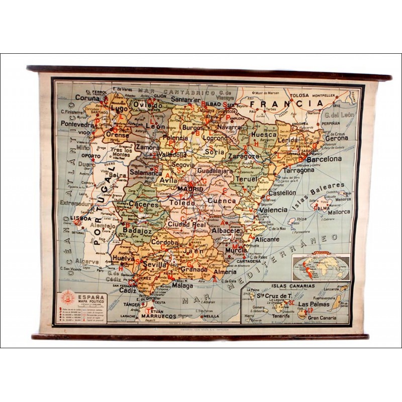
Pre-Constitutional Political Map of Spain for School Use. Years 40-50 of XX Century
Nostalgic political map of Pre-Constitutional Spain for school use. Printed on canvas.
Sold!
Amazing political map of Spain printed on canvas and made in the 1940s-50s.This is an educational map designed to be used at school, in quite good condition and with a really special charm. The map shows the Iberian Peninsula with the different provinces and regions as they were distributed and named in the period. We can also see Portugal and part of France, painted white and showing only the rivers, railroads and main cities. The map is attached to two dark-finished wooden rods and has a small nail at the top to unfold and hang it. The canvas this map is printed on is in amazing condition. We can only appreciate a tiny flaw at the back top side but it can scarcely be seen at the front. It does not interfere with the maps general good look. The printing is very well preserved and all the lines, colors and inscriptions are clearly reflected. The colors look wonderful and stand out for its good condition, and so do the words with their different letterings. The map shows the Spanish territory divided in the old-time regions that group the provinces. These are identified by their names in small black lettering, while the capital cities are identified by their initial in red. As for the regions, they are indicated by big white letters printed at the background: CV, G, A The regions are also identified by colors. At the bottom left corner we can see a cartouche with the symbol key, the scale and the publishers logo (Cartografía Edelvives). This fine educational map will bring a lot of memories to those who spent their childhood in Spain during the 1950s, 60s and 70s. It is a very special piece for its attractive look and historic interest. Measurements: Width: 47.2 in / 120 cm. Height: 36.6 in / 93 cm.

